Nagaur Fm
Type Locality and Naming
OUTCROP: The type section is not designated, good exposures of this formation are near Dhingasari (Pond section), Phalodi and Mohra. The rock unit consisting of brick red and reddish brown sandstones has been referred to as Nagaur Formation by Saproo et al., (1978) considering Nagaur as type area. [Original Publication: Saproo, M.K., Mahajan, A.C., and Jokhan Ram, 1978: Report on the geology of the area between Panchu and Bikaner, Western Rajasthan: ONGC Report (Unpublished)]
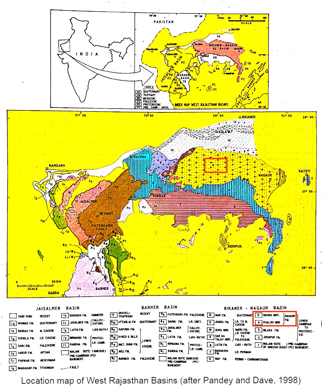
[Figure 1: Location map of West Rajasthan Basins (after Pandey and Dave, 1998)]
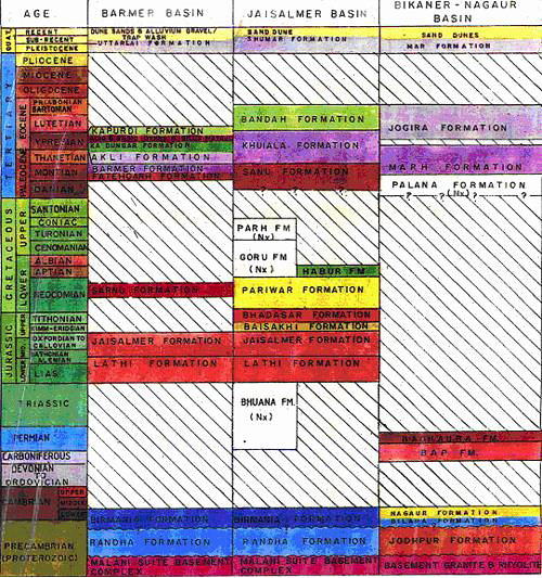
Synonyms: Shrivastava and Srinivasan (1962) grouped the strata of Nagaur Formation with Jodhpur Fm.
Lithology and Thickness
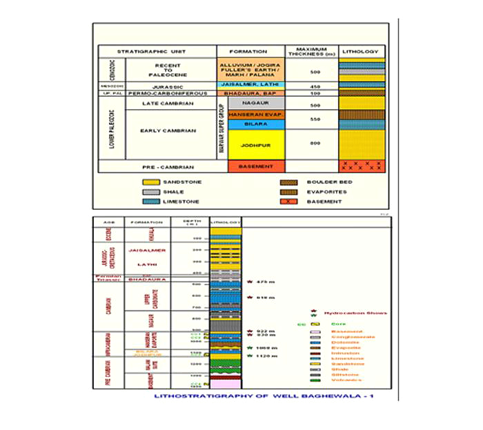
Sandstone and Limestone. The formation is divisible into Phalodi Member and sandy Mohra Member, comprises mainly purple to white colored limestone, grit, conglomerate with intercalation of sandstone, siltstone and silty clay. The Mohra Member comprises reddish brown to brick red, medium- to coarse-grained sandstone. Presence of evaporate sequence has also been noticed. Dhar and Khar (1977) estimated the thickness of Phalodi Member and Mohra Member to be more than 30 m and 180 m, respectively. In the boreholes where limestones of Bilara Fm have been encountered, the thickness of this formation may range between 220 m (Bhamatsar) to 345 m (Ravneri) (Saproo et al., 1977).
[Figure 2: Generalized and Subsurface Stratigraphy of Bikaner-Nagaur Basin ((from dghindia.gov.in)]
Relationships and Distribution
Lower contact
It overlies Bilara Fm (Early Cambrian) with a pronounced unconformity.
Upper contact
Its upper contact with Badhaura Fm (Permo-Carboniferous) is nowhere seen but it is conceived as gradational.
Regional extent
The Nagaur Fm though poorly exposed is extensively developed and widespread. It is poorly exposed and outcrops are located near Udasar, between Kudsu and Khara (East), Darbari station, Kotara and Salasar. Regionally the Nagaur Fm has more or less similar lithological characteristics.
[Figure 3: Stratigraphic Correlation of Rajasthan Basins (from dghindia.gov.in)]
GeoJSON
Fossils
Devoid of microfauna.
Age
Depositional setting
Additional Information


